Monday, May 16, 2011

Davenport to Hot Springs


A couple of miles before arriving, we walked under our first major highway, Interstate 40. Notice the white blazes on the road sign.

Once we arrived (all nine of us) we were greeted by a man named Curtis, who ran the hostel operations. With a concerned look on his face he told us there were only 4 bunks still available.

Then with a sly grin, he said, "Well, I guess you guys could stay in the barn".


Without a second thought we collectively said, "We'll take it!".

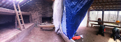
As we headed to the 100 year old barn, dark clouds began forming above. The change in weather made us feel like this was the right decision. That night, Tornados ripped through the Eastern Tennessee and Virginia area, killing several and leaving a wake of destruction behind. We were very fortunate to avoid the very severe weather, but did enjoy a powerful thunderstorm with an awesome light show. It may have possibly been the coolest place I've ever experienced a storm. We found out that morning that all of the hostels power had been knocked out during the night. Luckily, thru-hikers are well prepared for lack of electricity.


(The Barn)


(Panoramic photo from inside the Barn)

(Sage trying to Navigate over the very tricky bridge)

After a quick breakfast, and paying the $15 fee to sleep in the barn, we continued north. My next big destination would be a gorgeous mountain bald, with 360 degree views, called Max Patch. Here I would meet my Girlfriend, Pam who would be joining me for the next 20 miles. Pam is a very athletic woman, who ran Cross Country in College. Even with my hiking legs that had become well conditioned over the last 250 miles, I would find it hard to keep up with her at times. This may have had something to do with the fact that I was carrying 30 more pounds then her, but probably not. She is a strong one.

(Sitting on top of Max Patch)


(Pammy G on Max Patch)

(Looking up to Max Patch)

After hiking a few miles we stopped for lunch and to filter water from the nearby stream. I cooked us both a homemade meal of dehydrated spaghetti and vegetables, which she seemed to enjoy. Once we filled our bellies, we continued on to our destination which was 10 more miles. At camp, we met back up with my hiking friends, enjoyed some dinner and hot coco by campfire before calling it a night.

The next morning we would make an easy 10 mile cruse into Hot Springs, NC. I lightly mentioned to Pam to keep her eyes peeled for snakes, because they love sunning during a hot day like this. Like me, she isn't very fond of snakes.

About halfway to Hot Springs, I decided that I needed to rest a minute and take my 40 pound pack off my back. Pam asked politely if I minded if she kept hiking. I didn't mind one bit, and relaxed for about 5 minutes before continuing on. Now, that Pam had gained quite a lead on me, I needed to hustle to catch back up with her.

I finally found the wandering Pammy jamming out to her iPod about thirty minutes later. I followed behind her a short ways before she stopped and turned my direction. She very calmly said, "Baby, is that a snake?". I peaked over her shoulder and immediately saw what she was talking about. It was a fat bellied Black Snake laying across the trail absorbing the sunlight. I slowly walked up to the snake to get an idea of how we would pass. This 6 foot snake was in no hurry of moving. After a failed attempt of negotiating for his territory, I tapped his tail with my hiking pole. He didn't like being disturb one bit. Moving much faster than he originally eluded, he turned to me in the strike position. I found myself in my first ever starring competition with a Black Snake. In an attempt to appear less threatening, I took a step back.

Once the snake realized that we meant no harm and only wanted to pass by he began to slither up the trunk of a near by tree. Yikes! It hadn't crossed my mind until now, that I should also be looking out for snakes in the trees too.

That afternoon, Pam and I reached Hot Springs, NC. At the trailhead was an information bulletin board for hikers. It made my day to find letters and artwork about the Appalachian Trail ABC's from 4th Graders of Hot Springs Elementary school. Their letters were very informative and encouraging.

From the trailhead, we followed the A.T. marked sidewalk into town. It was about a mile before we entered Hot Springs.
(Hot Springs, NC)

Tired from the days hiking, we found rest on a set of shaded steps on Main Street. The first thing I did in town was walk over to the Dollar Store and purchase two ice cream cones. I figured that I better get two in case Pam wanted one, but if she didn't, I would be happy to help her eat it.

Hot Springs is the closest spot on the Appalachian Trail to my home in Asheville, NC, which is about 45 minutes away by car. After about an hour of lounging in town, my cousin Seth arrived to pick Pam and me up to go back to his house. Seth is married to my cousin Julie, and they have a beautiful home and three lovely kids.

Once we arrived at their house, their kids (Caleb, Adam, and Annabel) seemed to be super happy to have Pam and I visiting. Caleb and Adam immediately wanted to hear about my hiking adventures and rummage through the contents of my 40 Lb backpack, while Annabel wanted to spend most of her time with her new best friend, Pam.

(Caleb, Annabel, and Adam playing in my tent in their backyard)

Caleb wearing my pack. I'm pretty sure it weighs as much as he does.

                                       (Julie, Laney, Pam,Caleb, Me, Lucie, Amie and Annabel)

 
It was a great end to a wonderful week to get the opportunity to spend time with my family and share with them all, the exciting news from the trail. The boys were a litte sad when I told them that they couldn't come with me to Maine, but quickly perked up when we made an agreement to go camping together as soon as I return home.

The next morning Pam dropped me off back in Hot Springs, where I met back up with my hiking friends, who were preparing to start the days hike. They handed me a handful of flattened coins, which they laid on the nearby train tracks for entertainment. I am starting to notice a deeper bond between the group of estranged hikers. They are now even referring to our collective group as "the Tribe". I like it and felt proud to be reconnected with them again. But it's time for the this tribe to start moving north. Next stop; Erwin, TN.

Happy Trails!
TIN MAN


After passing Davenport Gap, which was a heartfelt goodbye to the Smoky Mountains, we marched on towards Standing Bear Hiker Hostel in Hartford, TN.

The Great Smokey Mountains

The Great Smoky Mountains
(With Emphasis on Great!)


After slack packing from Stecoah Gap to the Fontana Lake Dam. I had finally reached what North-Bounders would call the front porch of the Smoky Mountains. My 3pm arrival on a Tuesday afternoon was very subtle. I was surprised to find this majestic, manmade wonder to be very quite and desolate.
I walked down to the Dam’s Visitor Center, only to be disappointed to find a note on the door saying “Open May 1st”. The nearby gift shop left me with the same disappointment. So much for getting any Dam Souvenirs.


Just about that time my Mom rolled up in her car, bringing me a late lunch from Subway and my backpack that I regularly carry. It was a bittersweet reunion with my 85 Liter Osprey backpack, knowing that this 40 pounds of gear and supplies will be on my back as I climb up and over the highest point on the entire Appalachian Trail, Clingman’s Dome.

After telling my Mom, "Thank you and not to worry", I said, "Goodbye!" and made my way down to the shelter. I followed the sign that read, “Fontana Hilton Shelter 300 yards”. I suppose calling the shelter a “Hilton” meant that this was going to be a more luxurious experience than the shelters before. I envisioned a place with warm comfortable beds, running water, and modern day plumbing nestled quietly on the Lake’s edge. After I laid eyes on it, I was quickly brought back to the reality of being a Thru-Hiker.

It was a large barn like structure, painted red with a metal roof that was fenced off away from the Lake. There were no doors, only two large openings on opposite ends with a short walkway in between.

Inside, I discovered bunks that stretched the entire left and right sides of the walls, with no cushion from the hard wood surface. This fancy shelter was built to sleep a maximum of 20 hikers. I wasn’t really disappointed with the lack of electricity or running water, but I was a little about the Shelters proximity to the lake’s waters. The only access to the Lake was an overgrown foot path that dropped straight down 300 yards to one of the lakes less than desirable coves. The water seemed to be stagnant and not very appealing for an evening swim, so I opted out. I claimed my territory in the Shelter by laying out my Thermarest pad and Marmot Sleeping bag in a vacant spot beside the wall. There were already about 10 hikers lingering around the premises, chatting about what seems to be the most common topic of discussion; food.

With a belly full of Subway, I started collecting wood for the shelters fire pit. As darkness crept in, the fire was lit, and like bugs attracted to light, hikers began to gather. Since I was hiking faster than most, many of the faces were of new people which I hadn’t yet met. I introduced myself and got to know several fellow thru-hikers before retiring to bed around 10pm. I was so excited about hiking into the Smoky Mountains that I didn’t get much sleep.

The next morning I rose with anticipation with the rest of the shelters residence, only to realize that the weather would rather me be a little more patient. It was raining extremely hard outside, and I was left with the decision to wait it out or just go for it. So around 8:30am, and after an hour of waiting, I decided to make a break for the mountains in the rain. After putting my pack cover on, I suited up in my Columbia Titanium rain shell and Marmot Rain pants. I also decided that this adventure would be best shared with some music, so I loaded up Mumford and Sons on my Ipod and was off.

(The picture above is one I took as I walked from the Fontana Hilton towards the Fontana Dam in the pouring rain.)

Even though the rain was coming down very hard, my rain gear with stood the torrential test and kept me mostly dry. I walked fairly slow over the Dam, enjoying the panoramic scenery all around me. Once I has crossed the Dam, I approached a sign that marked the beginning of my 70 mile journey through the Smoky Mountains.

As I started the climb into the woods and up the mountains, blue skys started appear and the rain has finally stopped. After climbing several thousand feet, I came to ShuckStack fire tower at the top of the mountain. I decided this would be a great place to stop for lunch. I climbed to the top of the tower, to a small 5 foot by 5 foot room. While unpacking my lunch, I started to hear voices and could feel footsteps climbing up to the tower. It was a group a 5 people, who I had met the night before by the campfire at the shelter. Once they reached me at the top of the tower, they decided it would be a good idea to join me for lunch. Together, Sage, Sunkist, Pyro, Hawk Run, Fate, and I ate our lunch in the tiny tower. Once we finished our lunch, we continued the afternoon's hike to Mollie's Ridge shelter together.


(view from the top)

(Left to Right: Sunkist, Pyro, Fate, Hawk Run, and Sage)

(Mollies Ridge Shelter)

Legend has it that this area and shelter are haunted. The area was named for a Cherokee Maiden who froze to death while looking for a lost hunter and that her ghost still haunts the ridge.

I wouldn't consider myself as scared of ghosts; but I was happy not to encounter this Mollie.

After setting up camp for the night, I enjoyed chatting with my new friends around the camp fire. I learned much more about them personally than the night before. I found out that Sage, who resides in Virginia, just retired from the navy after 20 years, and was finally pursuing his life long dream to hike the AT. On top of being a husband and father, he is also a published author and pursuing his Doctorate in Psychology. Pyro and Sunkist also shared stories about their experience being in the Marine Core.

(Inside and Out of Mollies Ridge Shelter)

The next morning, we ate a quick breakfast and were back on the trail. We didn't have as much climbing to do now that we were on top of the Smoky Mountain's ridge line.


With a dense fog blanketing the entire area, it didn't take long to understand why these mountains are called Smoky. The fog was dense but, every once in a while, it would open up for an awesome view of the valley and Fontana Lake off in the distance. As we hiked north, the A.T. follows much of the Tennessee/North Carolina state line. It was a really cool feeling to walk the ridged stateline. You could look left and see Tennessee and right to North Carolina, both directions offered views that a Painter would love to capture.

After two solid days of hiking with my friends, I boosted ahead of them to meet my Dad and P. Lane on top of Clingman's Dome.

Clingman's Dome is the highest point on the entire A.T. standing at 6,684 feet. An observation tower at the top offers a 360 degree view on the land down below. The thick layer of fog and precipitation ruined any chance of good views, but every step and climb I made, reminded me that I was quickly raising in elevation. After hiking 12 miles I had finally conquered the top of the Appalachian Trail.

I had originally planned to hike 8 more miles with my Dad from Clingman's Dome down to NewFound Gap where we would meet P.Lane and go into Gatlinburg for the remainder of the weekend. But since the weather was bad, and I was already tired, we decided to go into Gatlinburg from there.

This turned out to be a great decision. The next morning I returned to Clingman's Dome with my girlfriend with much more enjoyable weather. The sky was blue and the views were amazing. I was extremely happy not to miss this.


After enjoying the visiting the observation tower and enjoyed the view all around, Pam and I hit the trail. We slacked packed the 8 miles from the tower to Newfound Gap, where we had parked her car. The section was a very beautiful section, hiking through a dense forest of Fraser Firs and Hemlocks.


Unfortunately, many of these tree are dead or dying due to an exotic insect species called the Balsum Woolly Adelgid. This tiny bug will kill an entire tree within five years of an infestation. The National park Service is working hard to eradicate this problem and save whats left of their beloved trees.


After Pam and I returned to her car, we drove back down to Gatlinburg. We ate dinner at a restaurant called Blaines, where we both have a few friends that work there. Blaines Staff is very friendly! One of their Bartenders even donated an extra backpack to aid my journey, which works great for people who want to hike with me but do not have a pack.

While sitting on the second level balcony, I noticed my hiking friends walking along the street. I walked down to greet them and to discuss their plans for leaving Gatlinburg soon. They told me where their hotel room was and for me to come by once I said goodbye to Pam.

That Sunday night, Pam would have to leave and return home and I would join my friends for the night at the Grand Prix Motel. The Grand Prix Motel is on the edge of town and is well known for giving A.T. a great rate and quality service. I did my laundry and got some good rest.

We all woke up early the next morning and started figuring out how we would all get back to the trail. Sage, Sunkist, Fate, and Turtle all had a free shuttle scheduled for 9am provided by the NOC Outpost. Hawk Run and I would try our luck hitch hiking the 15 miles back to the trail, something I've never done before this trail. We made a cardboard sign that read, "AT Hikers to NewFound Gap", and it worked great. We had only waited about 5 minutes before being picked up by and extremely friendly man and woman. After a quick introduction and explanation of where we were headed, we learned that both of these kind people were former thru-hikers many years earlier. The woman was even attending a 30 year reunion with her hiking partners to celebrate their thru-hike in 1981. Once we arrived at Newfound Gap, we graciously thanked them for the kindness and took a quick photo for the memory book.
After an enjoyable weekend in Gatlinburg, I was ready to be back on the trail. When I approached the trail head, I noticed a sign that said 1,972 miles to Katahdin, Maine. This was the first sign indicating that we are heading to Maine.


With only 1,972 miles to go, I was back on the trail. The second half of the Smokey Mountains would proved to be just as awesome as the first.

After about 5 miles we came to a giant rock outcropping on top of the mountain, called Charle's Bunion. I asked my friend turtle to use the Panoramic app on my Iphone and take a picture of me. I climbed down to the rocks edge and absorbed as much of the fresh mountain air as possible. This area also made for a great place to eat lunch.


We continued on over the tops of the Smokies. The entire day was filled with breath taking views to the left and right.


We eventually came to the last major scenic point before departing the Smokey; Mount Cammerer. On top of Mount Cammerer is an observation tower with full wrap around deck, it very much resembles a Light House without the shining light.

Once we reached the top, we were pounded by 50 mph or more gusts of wind, and had to move carefully not to be blown off the mountains edge.
(view from Mount Cammerer)

After enjoying the view for a while we eventually moved on towards Davenport Gap. This would mark the end of our time spent in the Smokey Mountains. It was a somewhat bitter sweet moment to leave. I was happy to have completed the Smokies but sad to be leaving them behind.

The Smokey Mountains not only provided me with tons of exercise, gorgeous views, and loads of memories; but it also gave me the opportunity to make eight new friends who had now become my trail family.

Until next time, Happy Trails!
- TIN MAN


Sunday, May 1, 2011

The NOC to Fontana

April 15h - April 19th


I am very fortunate that to have family that lives close to the trail in the Western North Carolina area. So to me, it only makes sense to take advantage of it while I can.

So after hiking to the Winding Stair Gap near the town of Franklin, I made a brief overnight visit to my Mom's house in Cullowhee, North Carolina. While I was there, I was able to resupply my food, wash my clothes, and sleep in a comfortable bed.

Feeling refreshed, I caught an early morning taxi from my Mom back to the trail. She dropped me off in the same spot she had picked me up the previous evening. After watching the four wheels of her Ford Fusion motor off in the distance, my attention was drawn to the small White Blaze on a wood post across the busy highway. After carefully crossing the highway, it was time to get back to business!

Today I have scheduled myself to hike 10.1 miles over Siler Bald to the Wayah Shelter.

Most of the people that I had previously been hiking with, went into the town of Franklin, NC to resupply and to also find a comfortable bed. Franklin is 10 miles away from the trail, so hikers going into town have the option of hitch hiking or waiting for one of the scheduled shuttles.

My personal Taxi allowed me to arrive back on the trail much earlier then others, so I found myself entering vast wooded wilderness alone. At first it was quite an eerie feeling, being several miles into the woods with no one else around. But that aloneness quickly subsided when I approach a beautiful waterfall with a bridge marked with a white blaze.


After a brief pause at the waterfall, I continued the climb over the mountain towards the shelter where I would end my day. As I got within a mile of the Wayah Shelter I began to feel large raindrops falling on my jacket and could hear the rumble of thunder off in the distance.

Once I got to the shelter, I assessed that I would need to quickly set-up my tent because occupancy in the shelter had already reached it's maximum.

I was able to secure my tent and began cooking dinner when the skys opened up and sheets of rain began to fall. This would be my first thunderstorm on the trail. When the weather is bad, there is not much to do around camp, so I called it an early night and was ready for bed by 6pm. The sound of heavy rainfall outside my tent made for a great setting to sleep like a baby.

The next morning I rose early to tackle a 16 mile day of hiking to the Natahala Outdoor Center (NOC) in Wesser, NC. This day had its own special charm. Being a Saturday, my girlfriend Pam made plans to hike the last 8 miles of my day into the NOC.

I met Pam at Tellico Gap, who was dropped off by my Mom. We then slacked packed our way towards the NOC.
As we descended the mountain towards the Natahala River, we could hear the growing sound of an announcers voice echoing through the woods below. When we finally arrived at the NOC we realized that we had arrived in the middle of a Professional Kayaking tournament.


Now that we had finished our day's hike, we both agreed that we deserved a big pizza! So we went directly to the River's End Restaurant and ordered the largest one available.

That night, we went back to my Mom's house to relax where I would be taking my first Zero Day the next day. A Zero Day is a term used by thru-hikers to refer to a day off the trail, which means Zero miles of hiking during the day. A Nero Day is a similar term that means only hiking a few miles for the day or near Zero.

Sunday morning, I awoke to my first Zero day. After hiking for 11 straight days and 135 miles I was more than excited to get some rest. I spent the day with my family. My Grandfather, who has taken special interest into my hike, came with my Aunt Jeany to see me. They brought lunch with them and while we ate, I shared with them the news from my journey. It was a very enjoyable day and I felt my body thanking me for the much needed rest.

Early Monday morning, I caught a ride with my Dad back to the trail for a 14 mile hike out of the Natahala Outdoor Center to Stecoah Gap. He arranged to meet back up with me at Stecoah Gap and allow me to slack pack the entire day. After carrying a 40 pound backpack for over 100 miles, I look forward to any chance I get to slack pack. Slack packing is when a thru-hiker carries a very light backpack, with only the bare essentials inside.

The opportunity to slack pack changed my typical days hike into more of a ridge running workout. My fast pace allowed me to finished the 14 mountainous miles within 4 hours. My timing was perfect! As I arrived to Stecoah Gap, finishing my hike, my parents car was approaching the parking lot at the same time. Happy to see them, I hopped in and motored off towards the closest eating establishment.

The next morning, I would slack pack one last stretch before arriving at Fontana Dam and the entrance into the Great Smoky Mountains.