Sunday, May 1, 2011

Hello North Carolina!!

Sunday April 9th - Thursday April 14th
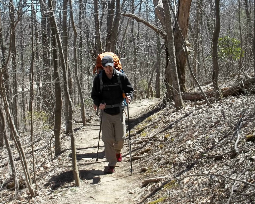
On Sunday, around 2pm, my cousin Mike and I parted ways at Unicoi Gap. Mike made sure to weigh me down by filling my belly full of pizza for lunch.
After a brief conversation and a few encouraging words from Mike, I was back on the trail!

To get out of Unicoi Gap, I walked straight up about a thousand feet or so, just for it to level off a bit, and then go straight back down again. Then repeat! Up, down, repeat. 

  I got on top of Tray Mountain (about 6 miles from Unicoi). The effort was justified. That night I stayed in the Tray Mountain Shelter (picture to left) and it was spectacular! It's a great place to view both the mountains’ sunrises and sunsets, and at night you could see what I think are the city lights from the little town of Helen, GA where I spent the night before. For the first time, I actually decided to camp in the shelter for the night. Even though I’ve heard the horror stories about little hungry rodents, I didn't have any problems.

The next morning I started hiking around 8am, and in a very relaxed form hiked to Dicks Creek Gap (near Hiawassee, GA). I hiked at a slower pace  because I knew that my Mother was going to pick me up in Hiawassee around 6pm. She lives in Cullowhee only a few hours away. I finished my 12 mile hike to Dicks Creek around 2pm and ended up paying this sketchy local guy named Mike to take me in his little red truck to Hiawassee.

This guy is well known for giving thru-hikers a ride into Hiawassee for $5 a person. But I didn’t care, I just wanted some food. I traveled with two brothers and we all were dropped off at a local steak buffet for a late lunch. Between my 4 trips to the buffet and 87 degree weather, I was ready for a nap. I walked back with the hiking brothers to the Hiawassee Inn where they were staying for the night. There I found a comfortable shade tree and took a nap until my parents arrived. I figured that I better take full advantage of having my parents close by while I still can.

The next morning I was dropped back at Dicks Creek Gap around 10pm. This day's weather was opposite of the day before. Unlike the weather that put sunburns on my arms, it was now cold, rainy, and extremely windy. As I hiked higher in elevation, this dense blanket of fog masked all that surrounded me. But I didn't let this slow me down. I cranked up my iPod and began another 12 mile day. I kept saying to myself, "only 8 more miles to North Carolina!".

Once I finally got to the shelter, the place was completely full. Packed like a sardine can, everyone was already snuggled in their sleeping bags chatting away and trying to stay warm. I made the decision the night before to bring my 2 person tent and was very happy about this at this point! My 1 person tent, which is half of the weight, was beginning to feel a little tight for my 6’3’’ frame. I quickly set-up my tent, made my dinner, and was passed out in my cocoon of a sleeping bag by 6:30pm.  Despite the 40 mph wind and 35 degree temperature, I slept like a baby!

When I finally got to North Carolina,I was a little disappointed with the welcoming comittee.  It was just a little wooden sign on a tree. I might have missed it if it wasn’t for the random American Flag stuck in it. But non-the-less, I had planned to document this occasion. I used a little tri-pod that Mike gave me and attached it to one of my hiking poles stuck deep in the ground. I snapped a few photos then quickly continued towards Muskrat Creek Shelter. This was a very tough part of the trail, with dense fog limiting my view to only 40 feet. I felt like I was on the 'Trailway to Heaven'! It just kept going up and up. I was just waiting for a big gust of wind to lay me and my heavy pack on my side. Luckily I had great rain gear and the backpack cover Mike gave me worked great!

The next morning I was slow to rise, due to the fact that I could feel the bitter pinch of the cold morning air aching for a chance to shake me down of any heat my body had collected.  I finally hit trail around 9:30am and was looking at another 12.5 mile hike to Carter Gap Shelter. The storm and rain had passed and this new day brought promise of blue skies and sunlight. This hike was a breeze in comparison and almost felt like a day off. The weather was great, I was in no rush, and the terrain was fairly flat even though I had to cross Standing Indian Mountain.  According to Cherokee Legend, a giant winged monster once lived on this mountain, and during the monster’s reign, warriors were posted on the mountain as lookouts. But as the story goes, a tremendous bolt of lightning struck the mountain and killed the monster. During the strike it also turned a lone Cherokee sentinel into Stone. This blast created a rock structure that resembled that lone Indian, thus given it the name “Standing Indian”. To me, it felt more like a big hill without any good views to enjoy along the way, and I didn’t notice any Indian either.

I arrived at Carter Gap Shelter just after 2pm and was one of the first people to arrive for the day. Having that privilege, meant that I got first dibs on where I wanted to lay my head for the night. Knowing that I had a long day ahead of me tomorrow, I decided to claim my place inside the shelter. This way I didn't have to deal with packing up my tent and bag. As more people arrived to the shelter the area became alive with activity as we began our daily after hike rituals. Unpacking, setting up camp, collecting and filtering water, making food, using the privy, etc...


This night was nice because it was the first time I got to share a campfire with a group of complete strangers. This crowd was from all over the globe: 2 guys from Germany (each here solo), A woman from Poland, Two female best friends from France who were in their mid 60s, A Canadian guy who made all of his gear himself, and the American hikers were from Florida, Chicago, and Texas. We talked of  several interesting topics by the fire, before I decided to retire to my corner of the shelter.

The next morning, I hiked 16 miles from Carter Gap Shelter to Winding Stair Gap (right outside of Franklin, NC). This was a fairly intense day and my feet and knees kept reminding me of it. Eager to get an early start, I decided to skip making breakfast and opted for the power bar instead. This decision allowed me to start my day's hike by 7:45am.  I hiked for about 6 miles before coming to Albert Mtn. Scaling this mountain was more of a climb than a hike. I believe it climbed something like 750 feet in 3/10th of a mile. But it was completely worth it at the top. There is a fire tower on top of the mountain, which is used by Park Rangers to see if there are any forrest fires in the near by area. The view from the top felt like you could see for 50 miles in every direction.


As soon as I continued on from the tower, I ran across snake #3. This time I was hiking with two other guys, which is about the best way to discover a snake. The guy who found it, just about jumped out of his skin when he saw it. It turned out to be a 3 foot Garder Snake, which is nothing major to worry about.

.

I finished the 16 mile day. My Brooks shoes are working out well.  Brooks sent me 3 pairs of Cascadia 6 trail running shoes as a promotion and for me to rate on my hike.   These have been rated the top trail shoe.  I made my decision to wear shoes instead of boots due to the blister factor.  These shoes are much lighter than boots, which was another big factor in my decision.  So far no blisters.  They have a stiff rock plate on the bottom to help support your feet.  I feel I made the right choice.  I am also coating my feet with Shea Butter to help heal them each day and to moisten them for the next day.  Feet problems are the number one reason that causes thru hikers to leave the trail.  My feet are sore, but I am ready to go again tomorrow. 

 I came to a road access point at Winding Stair Gap right before 4pm. The timing turned out to be great.  My Mother (who lives 35 miles from here) was available to pick me up and let me set-up camp at her house for the night. As soon as she arrived, I loaded into her car and we went directly to Hardee’s for a big juicy Cheeseburger!    It was amazing! :)


Monday, April 18, 2011

Hiking with Mike

April 7th to April 11th

After sleeping like a baby in my tent, I woke just as the sun started to rise over the mountain horizon.  I quickly went to work to get my morning chores done so I could soon start my first full day of hiking.  I made a quick breakfast and some coffee, then began to pack up my tent and my backpack.  


Before I left, I needed go to the near by creek to wash my cooking pot and also filter some drinking water for the day.  Once I finished all my morning chores and was ready to start hiking, I noticed that everyone else was already gone.  My thought was that I either needed to wake up earlier or work faster.

I have planned a 12 mile day which at the end of my day will meet up with my cousin and fellow AT enthusiast, Mike York.  The plan is to meet Mike at Woody Gap where we would take a shuttle to the local Hiker Hostel for the night.

Once I started hiking I quickly realized that I  neither needed to wake up earlier, nor work my chores faster, because my hiking pace was allowing me to catch up with and pass just about everyone from camp.  After about mile 10, I started to feel a little funny.  I noticed that my vision was becoming slightly compromised.  I would look down at the ground and then back up at my surroundings as a way to check my vision.  Sure enough, a sickly feeling that I am all too familiar with was starting to set in.  I was getting a migrane headache.  

I haven't had a migrane headache in years, but here I am on Day 2 of my hike and can feel the headache setting in, as I try to lug out the last two miles of the day.  Once I got to Woody Gap, I immediately took my pack off, swallowed a couple ibuprofen, and laid down.  It would be only a few minutes later before my cousin Mike and the shuttle arrived.  I said hello to Mike and began to load my bag when my nausea level jumped to about a 10.   I quickly stepped away and went over to the scenic overlook's edge and let it go.   There went my breakfast!  I will spare you the details.  Almost immediately my body started to feel better and my headache started to fade.  I'm sure this gave Mike lots of confidence about hiking with me the next couple of days.

After a very curvy shuttle ride down the mountain and successfully holding down the rest of my breakfast, we found ourselves pulling into a beautiful log cabin known as the Hiker Hostel in Suches, GA. 

Mike and I were given a bunk bed and educated about the hostels many amenities.  I immediately decided it would be in my best interest if I laid down for an hour or so while Mike and the other hikers went into town for supplies and dinner.   


The next morning at 7:30am, our host made us an amazing breakfast of pancakes, eggs, grits, and fruit juices.  It was just what I needed to recharge my energy after a migrane.  After breakfast we loaded back into the shuttle headed back to the trail.  I felt like a new man!


We had plans to hike over Blood Mountain and set-up our camp just past the Mountain Crossing Outfitter store in Neels Gap.  It was shaping up to be another beautiful day for hiking as our hiking.  Right after lunch, we found ourselves hoofing it up Blood Mountain.  As we climbed in elevation, we noticed that a dense fog was sitting on top of the mountain, limiting it's 360 degree views to only a few feet.  Time to get out the Jackets.


A picture I took of myself with Blood Mountain Shelter in the Background.

Blood Mountain is the highest point of the Appalachian Trail in Georgia.  It got it's name after a bloody battle between the Cherokee and Creek Indians.  It is said that the mountain ran red with blood afterwards.  

As we descended the mountain and the dense layer of fog, we came into a little town called Walasi-Yi. Walasi-Yi in Cherokee means 'Land of the Big Frogs'.  Walasi-Yi, also known as Neels Gap offers a full service outfitter and hostel which the AT literally goes right through (Notice the White Blaze on the wall in the picture above).
Once into Neels Gap there was lots of commotion in the air pertaining to a mischievous Black bear in the local area.  But since logding at the hostel was already completely full, our best option would be to continue hiking and make camp a Bull Gap a little over a mile away.

Even the trees tried to warn us about the bear activity.

We finally arrive at Bull Gap around 7:30 p.m. It is a nice open level spot that has plenty of room to set up our tents.  There is a stream down the hill where we can get more water and a fire pit that others have used, where we can finally make a campfire for the night.  We see a few more hikers pass through on the trail before one of them decides that he will stay at Bull Gap too.  He says his name is Brandon (no trail name yet), but Mike quietly refers to him as "Bear Option #3".  We were glad to have him join us for the night.  Brandon seems to be well educated in the outdoors and tells us about his fool proof bear bagging system for hanging your food in the trees.  Since neither of us had much experience to challenge this fool proof system, Mike and I decided to put our food bags up with Brandon's.  So at the end of the night, we hung our food in a tree about 100 yards from our camp site.  

The next morning I hear Mike moving around and he finally walks up to my tent and says, "Grayson, I've got good news and bad news!" he added "The good news is that you're still alive! The bad news is that we've been raided by the bear..." 

I immediately jumped out of my tent to assess the damage.  To my surprise, I noticed that one of the three bear bag was still hanging in the tree.  But the others were reduced to two different piles of trash covered in a thick layer of bear saliva.

Winner, Winner, Chicken Dinner!  I'm not sure why, but the bear who devoured all of Mike's and Brandon's food supply decided to leave my food bag untouched and still hanging in the tree.  I guess he had gotten his fill.  Luckily I had enough food in my bag to share with Mike for the remainder of our Hike.

After we cleaned up our mess and packed up our camp, we said goodbye to Brandon as he needed to back track to the Outfitter store to restock his food supply.  We continued north.

As we continued on our hike, we quickly assessed that if we add an additional 4 miles to our already planned 15 mile hike for the day, we would end up at Unicoi Gap where Mike's car is parked.   At first, I was a little hesitant to hike 19 miles after already getting a late start, but once Mike mentioned a warm hotel bed and a hot dinner at a restaurant, I was all for it!   As we marched up and down through mountains following the white blazes, I dreamt of a bear free hotel room and a hot meal, that I didn't have to prepare.  This thought fueled our motivation to get to Mike's car as soon as possible.  

Around 8:30pm we finally finished our 19 miles and made it to Mike's car right as darkness set in.  We were both exhausted and walking a little funny from our sore knees and feet.  We quickly piled in to his car and started following the yellow blazes (road lines) towards the town of Helen, Ga.  Once in town Mike quickly fulfilled his promise of a hotel and hot meal, all my aches and pains quickly subsided.  I was happy to be off the trail for the night.   

I am extremely thankful for the opportunity to hike with my comical and wise cousin Mike.  Throughout our 31 miles of hiking together we talked about many different topics.  He told me stories about our Grandfather and my Aunt Loretta (Mike's Mom) who both passed away before I was born.  Mike had me laughing throughout the entire hike with his very funny personality.  I was truely sad to see my journey with Mike come to a conclusion.

The next morning Mike treated us to a big pizza lunch before taking me back up to the trail head at Unicoi Gap.   We shared our sober goodbyes and parted way.  I joined back to the marriage of my adventure, as where Mike returned home to his family (4 kids from college age to 4)  and loving wife.

I can not thank Mike enough for all of his support of my hike and my mission to raise money for the Children's Heart Foundation, but Thank you again Mike!  

You can read Mike's Blog of our hike at: 


Please help me to raise money for the Children's Heart Foundation by donating to the link below.
Happy Trails!
Grayson


Sunday, April 17, 2011

Springer Mountain


April 6th, 2011 - Springer Mountain, GA
 
After 8 months of planning and preparation, the time has finally come for me to begin my northbound hike of the Appalachian Trail.  Thanks to great support from my family, friends, and a few sponsors, this dream has now become a reality.  A big thanks to JT Vonlunen and the Gear to Grow Organization for contributing a large portion of my gear needed for this journey.  Also Thank you to Brooks running for making and donating the best trail shoe available; The Brooks Cascadia 6.


This picture shows the gear that I have collected over the last few months to aid me along my journey.  I will not be taking all of this gear with me on the trail at once, but I will be using each piece of this essential equipment throughout various stages of the trail.  I plan to go into greater detail about my gear in the near future.


After a three hour drive from my mom's house in Cullowhee, NC, we finally arrived at the base of Springer Mountain.  Excitement doesn't quite express my emotions.  Yea, I was excited to get started, but I was also starting to wonder what I was getting myself into.  Do I really want to live in the woods for the next 5-6 months?  What's in store for me?  I don't know but I am ready to find out. 
From the parking lot, it is just a mile to the top of Springer Mountain to get to the start of the trail.  Dad, Phil Lane and I headed up the mountain.  

From left to right: My Dad, Me, Phil Lane


At the top of the mountain I sat down beside the famous AT plaque that marks the start and finish of the trail at Spring Mountain.  On the right side of the rock was an imbedded metal box that houses a notebook of the 2011 Thru-hiker registry.   A 'Thru-hiker' is someone who completes the entire 2,181 miles of the AT in 12 months or less.  Each year thousands of people attempt to become a 'Thru-hiker' of the AT, but only about 20% will actually complete the entire trail.  With my intentions to thru-hike, I grabbed the notebook and quickly made my mark as an official AT hiker. 

The view from the Top of Springer Mountain

While sitting on a giant slab of rock, I quietly gazed out over the beautiful mountains in the distance. Considering the journey that lay ahead of me, my usually active mind went silent.  My presence at that moment felt so good.  I closed my eyes for a few moments and began to say a prayer for protection for myself and also for my family which I will be away from for the next 5 months.  It was a beautiful day, and just the way I hoped it would be.  The saying, "A journey of a thousand miles, starts with one single step" never felt more accurate.  Except, this journey is over TWO thousand miles!  Well, I better get to stepping!


My pack felt pretty heavy, especially when hiking up a mountain.  It weighted in at 42 lbs, and that was without water.  I probably had at least 10 lbs of food, which was way more than I really needed to carry at once.  I have plenty of opportunities to resupply my food and other necessities when needed.  But food is important!  Most Thru-hikers burn 5,000+ calories per day.  It's hard to replace that with no easy access to a fast food joint.  

My Dad has helped me with most of my food supply.  Several months earlier, we started experimenting with dehydrating different foods for the trail (i.e. pasta's, vegetables, meats, and fruits). He even invented his own protein bar that tastes way better than any Protein bar you can get at the grocery store.   He calls it the Trail Magic bar.


After hiking with me up to the summit of Springer Mountain and back down to the parking lot, Dad gave me a big hug and we said our goodbyes.  But with the aid of my At&T Iphone, I will be able to stay in constant contact with my friends and family.  I wouldn't have been able to start this adventure without the help from both my Mom and Dad.  Thanks Guys!


One last photo taken by my Dad as I disappeared into the woods with my new hiking friend Christoff from Germany.  Christoff and I chatted as we made our way to the first shelter of the journey.  Hawk Mountain Shelter was just over 7 miles from the top of Springer Mtn, which was good considering that it was starting to get late in the evening. 


Around 6 O'clock Christoff and I arrived to a packed shelter with many little tents scattered throughout the area.  I quickly claimed my territory and began to set up my little humble home as the sun started to set.


As sun disappeared behind the mountain, I made a quick dinner and started the think about the days that lie in front of me on this great Appalachian Trail.  Doubts and negative thoughts starts to race through my mind.  What had I really gotten myself into this time? 

Once reality sat back in, I realized that in order for this journey to be successful I have live each moment as comes and not to get lost in the magnitude of the destination.   After all it's the journey that is the most important part of life anyway.  

Happy Trails!

Grayson


Sunday, April 10, 2011

Introduction


Hi.  My name is Grayson Deal and I am currently hiking the Appalachian Trail.  There are many reasons that compelled me to begin this journey.  In 2009, I had  Heart Ablation Surgery to correct the irregular arrhythmia pattern of my ticker.  This irregularity caused me to black out during a pick-up basketball game with my friends.  When I awoke my heart was beating at 318 beats per minute, and my head ached from the concussive impact with hardwood floor.  After being rushed to the hospital in the back of an ambulance, I was told by the Doctor that I would need surgery.  On December 4th, 2009 I underwent the surgery at Mission Hospital in Asheville, North Carolina.  On Dec. 5th, I decided I wanted to hike the Appalachian Trail. 


This experience taught me a great deal.  At the time, I was completing my second year as a Business Development Representative for a major software company in Greenville, SC.   I am extremely thankful for this job, it taught me a great deal and introduced me to some great friends.  But now, I wanted to apply this education towards something closer to my heart.  This is where the vision for the Hike 4 Heart Foundation started to take fruition.  

As a kid, I loved to be in the woods.  Camping and hiking trips with my Dad were a regular occurrence.  We once even created our own hiking trail through the woods that surrounded our house.  I guess you could say that I found something special about taking a trip through the vast forestation of trees.  Through out my life I've lived in many different areas, but I have always lived within a short drive of the Appalachian Trail.  At age twelve, a good friend of mine and mentor took my best friend and me camping on the A.T. at Grayson Highlands in Virginia.  This was an awesome experience where I not only learned of this great trail's length, but also what the stars really looked like at night when the city lights are gone.  I dreamed of hiking the entire trail as a kid, but until now, it was only a distant dream in the back of my mind.

While laying the hospital bed that December morning, I decided to make this dream a reality.  I also concluded that it would be selfish to make this journey alone.  I have been given this opportunity to make this childhood dream a reality, and large in part to the successful heart surgery and new perspective gained from the experience.  So I decided I would dedicate this kid's dream of Hiking the A.T. to helping advance the research in the medical field pertaining to the heart!  So on April 6th, 2011, I took my first steps on the 2,181 mile trail headed north from Georgia to Maine for the Children's Heart Foundation.

I am doing this for myself, to experience what is real and what is truly important in life.  But I am also using this opportunity to raise money for the children and their families who are affected by congenital heart problems.  Please join me on this journey and help me to raise money for this very worthy cause.  Every dollar donated goes directly to advancing the research to finding a cure to eradicate Congenital Heart problems. 

Happy Trails!
Grayson Deal